Caribbean Idyll
Exploring the Caribbean - (part three)
Guadeloupe to St. Maarten
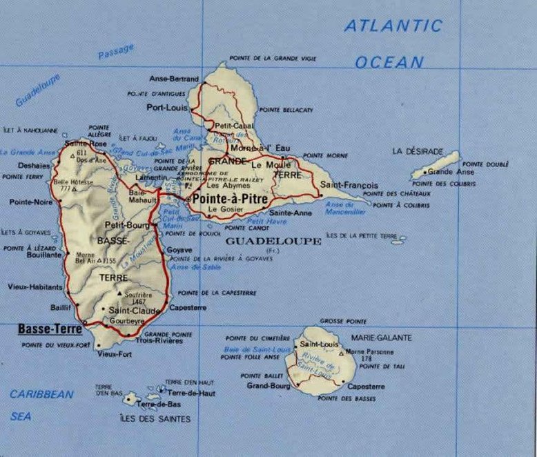
Click here for a map of the Guadeloupe. More detailed maps are available in the text.
We extended our stay in Guadeloupe as the finding and fitting of a new bilge pump took longer than anticipated. Jim's current saying, which he feels is very appropriate and repeats several times a day: "everything is difficult, nothing is impossible". Jim has finally been able to fit a new bilge pump: it whirrs and clicks but as he had to completely drain the bilge to fit it does not know if it will suck out water, however, he does not feel inclined at the moment to throw water down there. We are making ready to go through the Riviere Salee, it gives me a queasy feeling just to think about it. We have to anchor in the river just by the bridge today so the bridgeman knows we are there to open the bridge at 0500. We then go quickly as we have limited time to get to the next bridge which is timed to be open. The depth and width of the river is quite limited. When we get to the northern end we then have a bay full of reefs to negotiate (a 5 mile buoyed channel) before we head to open sea and the next island. We are not sure where we will stop, it depends on weather, time of day etc.
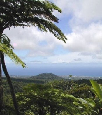
The petrol strike was supposedly over on Monday so on Tuesday we hired a car and toured part of the west wing of the island - the mountainous bit called, to be contrary, Basse-Terre (Click here for a map). Guadeloupe is shaped rather like a butterfly, with two "wings". We went to see the Chutes de Carbet (waterfalls) of which there are three. Where we parked we could see the two highest ones, and walked to the bottom of the second highest, an impressive 110m drop.
We also went on to the Parc Archeologique des Roches Gravees. This combined a lovely botanical park with native fruits, flowers and vegetables together with the petroglyphs dated around 300AD. These were simple representations of human faces carved by the Arawaks, the original Indians who were wiped out by the Caribs who in turn were wiped out by the Europeans. Finally we drove into the Parc National as far as possible up La Soufriere,1467m high and still active. We climbed up through scrubby vegetation and coloured mosses and lichens, with sulphurous fumes making our eyes smart from time to time. After about an hour we found ourselves by the Grande Faille, a giant fissure in the volcano, and the sign telling us that access to the summit was "interdit" for safety reasons. So we climbed on past that, until we reached two large gouffres, one belching sulphurous steam. As the sun had disappeared, and cold swirling clouds surrounded us we decided to return. Just a few thousand metres down and we were back to blue skies, hot sun and tropical forests again.
This account now continues in Sint Maarten
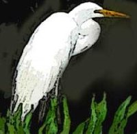
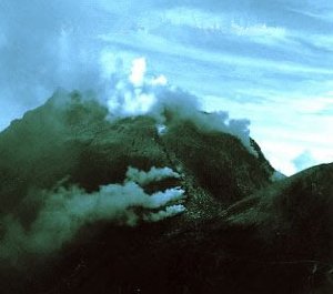
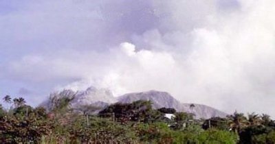
Bilge pump tested properly before we left Guadeloupe - all ok. Our trip through the Riviere Salle (on Guadeloupe - Click here for a map) was an interesting experience and not for the faint-hearted (thats R speaking). It was very shallow in parts, in fact where we anchored overnight we were aground for a while. We enjoyed seeing the white egrets flying in to roost for the night in the mangroves - must have been hundreds of them. After an anxious few minutes coming up to 05.00 as to whether the bridge would open, we saw another vessel on the other side waiting, and sure enough, the bridge opened, the other vessel came through and we were heading north. It was a peaceful trip as dawn broke threading our way along the channel (it was well buoyed). We came out into the Grand Cul De Sac Marin and it was like glass, with no hint of all the shoals waiting to snatch at our keel! The buoys were hard to pick out in the early light but we did negotiate it all safely in the end, and set sail for St Kitts. It was a 24 hour sail, so we were able to see Montserrat well in the daylight, and miss Redonda before passing Nevis in the dark. The volcano, Soufriere, in south of Montserrat was smoking away and we could easily see the recent ash flows coming right down to the sea, as well as the new prefabs of St Johns in the north of the island where the locals have been rehoused.
This volcano began to erupt in 1995, and by 1997 more than 80% of the town of Plymouth had been destroyed.
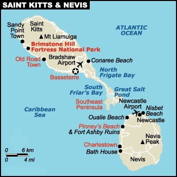
(Click here for a map). We
reached St Kitts ahead
of daybreak so hove to until we could see well enough to get into the marina.
This was just as well as the damage caused by hurricane Lennie had left just
concrete posts where once had been a large dock, and the marina itself had wreckage
in the entrance. We managed during our short stay on the island to do a round
tour of the north by various buses. At one village, where the bus left us to
turn round and return to Basseterre, we got talking to a couple of locals. We
explained that we did not have time/money to do the trip by taxi and all the
buses passing were full, so they stopped the school bus for us and we spent
the next 25 minutes in the company of giggling schoolgirls! The countryside
was quite different to other islands, large tracts of land given over to sugar
cane which was just being harvested. We saw the the trains used to transport
the cane to the processing plant (steam-driven) for the production of molasses
and sugar. There were lots of disused windmills and chimneys, reminiscent of
Cornish tin mines. For our second day on the island we took a taxi (no buses
available) to get to the beaches on the south of the island. We shared South
Friars with a few local people, a pelican and a couple of mongeese! It was a
beautiful place and we enjoyed several swims, as well as a drink at Shipwreck
Bar where we chatted to the owner whose mother lives in Birmingham! We anchored
out overnight then made an early 5.00am start traveling north again and arrived
in St Martin with 30 minutes to spare before the bridge opened to let us into
Simpson Bay Lagoon. We are now in a marina on the Dutch side of the island (Sint
Maarten - (Click here for a map). Our
main focus is shopping - for a dinghy (ours is too small and has a leak) and
an outboard engine (ours functions intermittently). This morning Jim introduced
us on the local cruisers VHF net and announced our needs which have provoked
a couple of people to dinghy over and visit us, and some useful advice. This
afternoon we are taking a bus to the French side to look at a chandler there.
The lagoon is very sheltered and is home, not only to a lot of cruisers, but
also to a wealth of birdlife including pelicans, terns, herons and egrets. There
are also some large things in the water which we have just missed seeing a few
times - fish of some sort, but pretty big! It's a bit noisy every two or three
hours because the airport runway ends at the lagoon!
***Note: We will be at the Grenada Yacht Club, PO Box 117, St Georges, Grenada, West Indies until 12 August if anyone wishes to write there to us c/o S.Yacht "Avalon"